Comprehensive Agricultural Management Tools
Everything you need to manage farmers, fields, and environmental compliance in one app
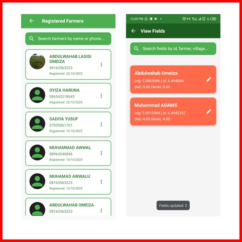
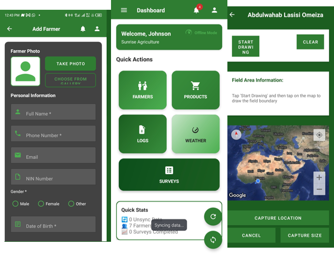
Comprehensive farmer registration with photo capture, personal details, and location tracking for complete records.
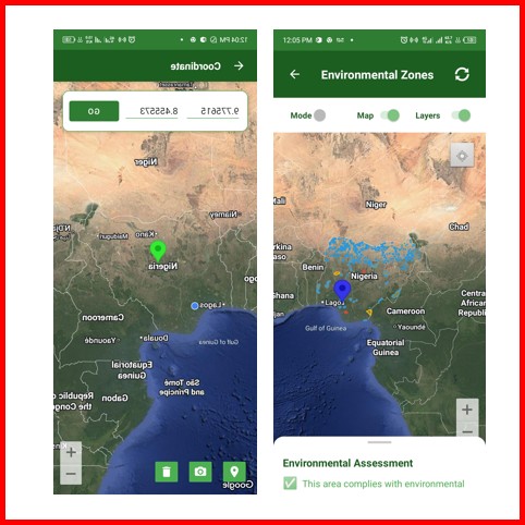
01Draw precise field boundaries using GPS, capture polygon coordinates, and calculate accurate farm sizes.
02652 protected zones across Nigeria including forest reserves, national parks, and deforestation-prone areas.
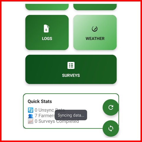
03Full functionality without internet. All data syncs automatically when connection is available.
04Create and fill custom survey forms offline with photo, audio, video, GPS, and signature capture support.
05Intelligent environmental assessment, risk analysis, and agricultural recommendations powered by AI.
06Powered by Modern Technology
Enterprise-grade features designed for agricultural field agents and administrators
Real-Time Sync
Google Maps Integration

Biometric Security
Database Management
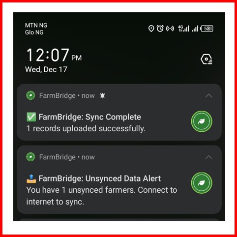
Notification System
Welcome to Farm Bridge
About Our Platform!
Farm Bridge is a leading offline-first agricultural management platform. We provide field agents with comprehensive tools for farmer registration, GPS field mapping, environmental compliance, and survey management—all without requiring constant internet connectivity.
Work seamlessly in remote areas without internet. All data syncs automatically when you're back online.
652 environmental zones mapped to ensure sustainable farming practices and regulatory compliance.
Benefits for Agricultural Agents & Organizations
Designed specifically for field agents working in the agricultural sector
No Internet Required
Full functionality in remote areas without network coverage.
Comprehensive Data
Track farmers, fields, surveys, and environmental zones in one place.
Environmental Protection
Ensure compliance with environmental regulations and protected zones.
Data Analytics
Track field agent performance and farmer registration statistics.
Environmental Zones
Offline Capable
Biometric Auth
Contact Us
Have questions? We'd love to hear from you. Send us a message and we'll respond as soon as possible.